
 |
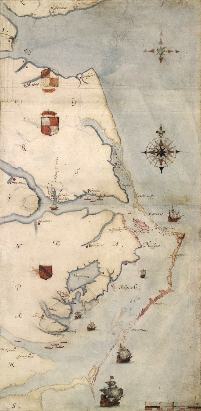
| Detail from La Virginea Pars by John White |
- For more information, see "Hidden Images Revealed on Elizabethan Map of America" from the First Colony Foundation.
- For a detailed report on the finding, see "Examination of patches on a map of the east coast of North America by John White," a report (in PDF format) from the British Museum.
- For more information, see "Researchers say they have new clue to Lost Colony" from Yahoo! News.
No comments:
Post a Comment