 |
| Map of the West Coast of Africa from Sierra Leone to Cape Palmas, including the colony of Liberia, 1830. |

18 June 2013
Defining Lines: Cartography in the Age of Empire — Duke University
09 June 2013
La Salle's Great Lakes Ship Found?
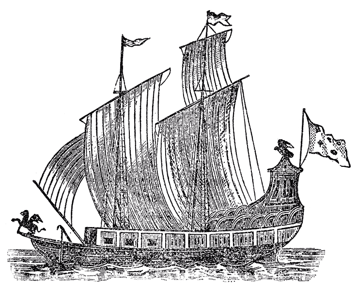 |
| Woodcut of La Salle's Le Griffon, lost on the Great Lakes in 1679. (From Father Louis Hennipin, Nouvelle Decouverte, Utrecht, 1697.) |
The Great Lakes Exploration Group is soon set to take French archaeologists to the floor of Lake Michigan to determine if the wreckage they have found are indeed the remains of Le Griffon, that disappeared, presumed sunk, in 1679. Le Griffon was built by order of the famed French explorer René-Robert Cavelier, Sieur de La Salle.
- "Shipwreck explorers set to unravel Great Lakes mystery," UpNorthLive.com, by Nathan Edwards
- "Expedition team set to identify wreck," video from UpNorthLive.com
- Great Lakes Exploration group
28 April 2013
"Explorers," Crystal Skulls, and Lawsuits Aplenty
 |
| A crystal skull at the British Museum (ID Am1898C3.1 ), similar in dimensions to the more detailed Mitchell-Hedges skull. |
The "crystal skulls" are the central plot element for the blockbuster 2008 film Indiana Jones and the Kingdom of the Crystal Skull, where the intrepid archaeologist/adventurer Dr. Henry "Indiana" Jones, Jr., hunts down the mystery behind the artifacts. Mitchell-Hedges is even mentioned in the film.
But in late 2012 Belizean archaeologist Jaimie Awe, director of the Institute of Archaeology of Belize, sued Paramount Pictures, Lucasfilm, and Lucasfilm's new owner Disney for illegally profiting from the skull's likeness. Awe considers the skull a Belizean national treasure, and the use of the skull as a plot device exploitative. Awe is also suing the Mitchell-Hedges family's heirs for the return of the skull.
The Mitchell-Hedges crystal skull, which the self-promoting adventurer Mitchell-Hedges claimed he unearthed from a 1924 dig at the Maya city of Lubaantun, in then British Honduras. Howgego's research, however, has poked holes in many of the claimed explorations and stories of Mitchell-Hedges's life, while scientific research into the skull has concluded it is probably a twentieth-century forgery, made with modern tools.
Nineteenth-century colonial adventurism, early twentieth-century archaeology, late twentieth-century New Ageism, and twenty-first-century movie magic are all mixed up in the interesting story of the crystal skulls.
- "Frederick Albert Mitchell-Hedges (1882-1959): Materials towards a definitive biography" by Raymond John Howgego
- "The Skull of Doom: The Mitchell-Hedges crystal skull: Fact, fiction, and the creation of myth," Archaeology by Jane MacLaren Walsh
- "Indiana Jones Crystal Skull Lawsuit Raises Questions of Hoax," LiveScience by Stephanie Pappas
20 April 2013
500th Anniversary of the Piri Reis map
 |
| Surviving fragment of the Piri Reis map (1513) showing Central and South America shores. |
The 1513 map shows the Caribbean and the coast of South America soon after the European discovery of the Americas. One written inscription on the map tells of its sources, one "a map drawn by Qulūnbū in the western region." Qulūnbū is Columbus, and scholars such as Gregory McIntosh note that the map's features are similar to the geographical notions of Christopher Columbus.
The Piri Reis map has also served as fodder for "alternative historians" who claim it depicts evidence of Atlantis, an ice-free Antarctica, unknown Chinese voyages around the globe, or even extraterrestrial mapping of the globe.
Turkey is celebrating the anniversary with exhibitions around the country. Ankara University hosted the International Piri Reis Symposium on April 12, 2013, with speakers from Turkey and around the world. Even Google got into the act with a Piri Reis map Google Doodle on April 7.
- Gregory C. McIntosh, "The Tale of Two Admirals: Columbus and the Piri Reis Map of 1513," Exploring Mercator's World: The Magazine of Maps, Geography, and Discovery
- "500th Anniversary of the Piri Reis Map," Google Doodle
- "500th Anniversary of Piri Reis is commemorat[ed] through Turkey," Istanbul Convention & Visitors Bureau
- "Historians, geographers to gather for Piri Reis," Hurriyet Daily News
01 March 2013
Charting the Land on the Ocean: Pacific Exploration, 1520-1876
 |
| Maris Pacifici by Abraham Ortelius in his Theatrum Orbis Terrarum (1589) |
It is well worth taking a look!
26 February 2013
Society for the History of Discoveries - Session Proposal: “Rediscovering Morocco”
Society for the History of Discoveries, Oct. 31-Nov. 2, 2013, Tampa, FL
Session Proposal: “Rediscovering Morocco”
This session seeks to unite disparate European explorations and penetrations into Morocco, while at the same time papers may address Moroccan explorations and penetrations into Europe, the Americas or the East. Particular areas of inquiry might address: transatlantic exploration—Native Americans to Morocco, or North Africans to the Americas; European exploration and colonization of Morocco and Moroccan exploration and “colonization” of Europe; African (ie sub-Sahara, Ethiopia, Egypt) exploration of Morocco, and vice versa; or, travel diaries and narratives of European travelers to Morocco, or Moroccan travelers to Europe.
Please send inquiries and abstracts to Dr. Lauren Beck (lbeck@mta.ca) and Dr. Jim Matthews (matthews@iwu.edu) before March 25th.
15 February 2013
"Dr. Livingstone, I presume?"
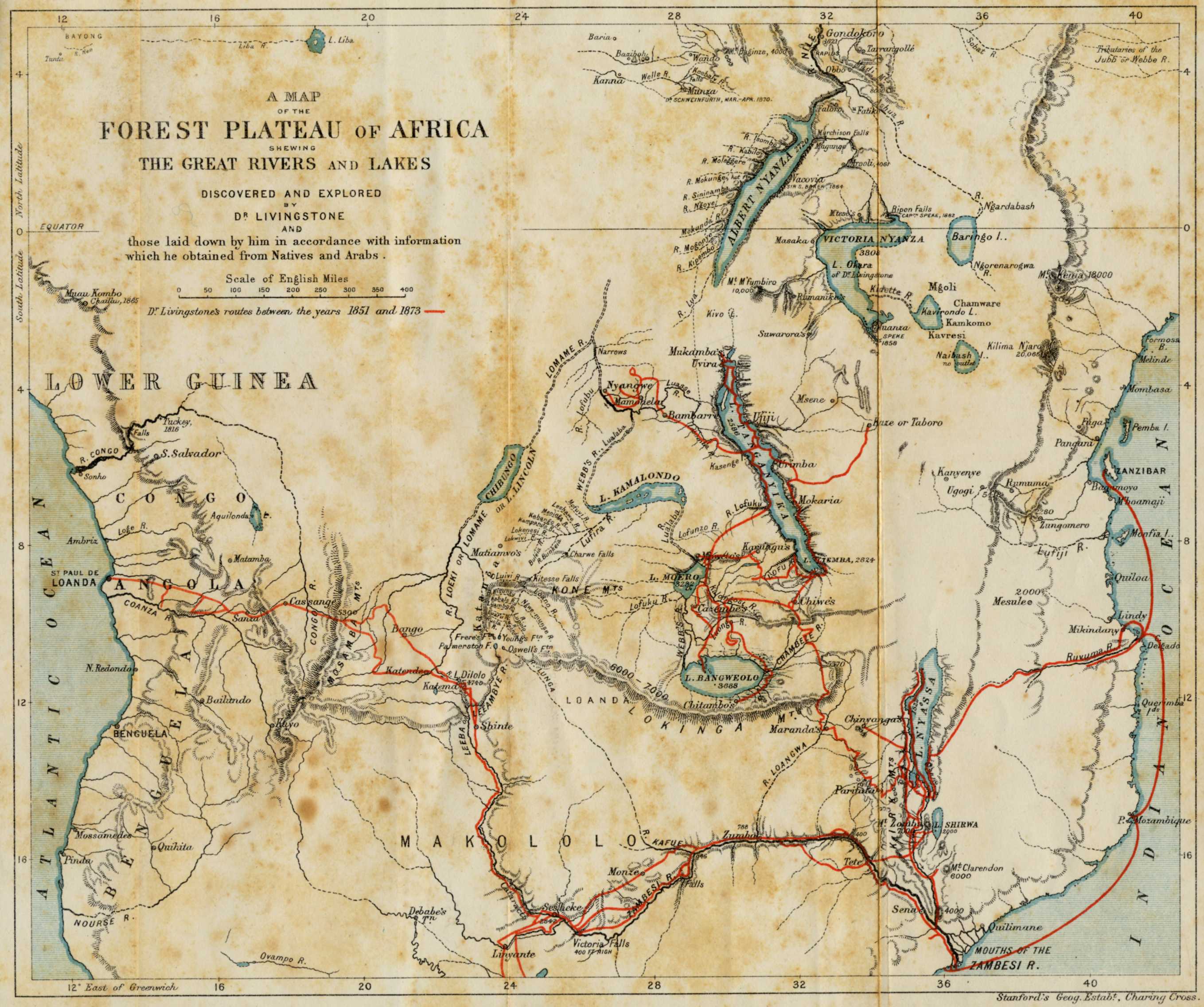 |
| Map of the Travels of David Livingstone in Africa, 1873 |
This is one of the several events meant to celebrate the 200th anniversary of Livingstone's birth that are planned for the year 2013 in both Europe and Africa.
Subscribe to:
Posts (Atom)