
 |
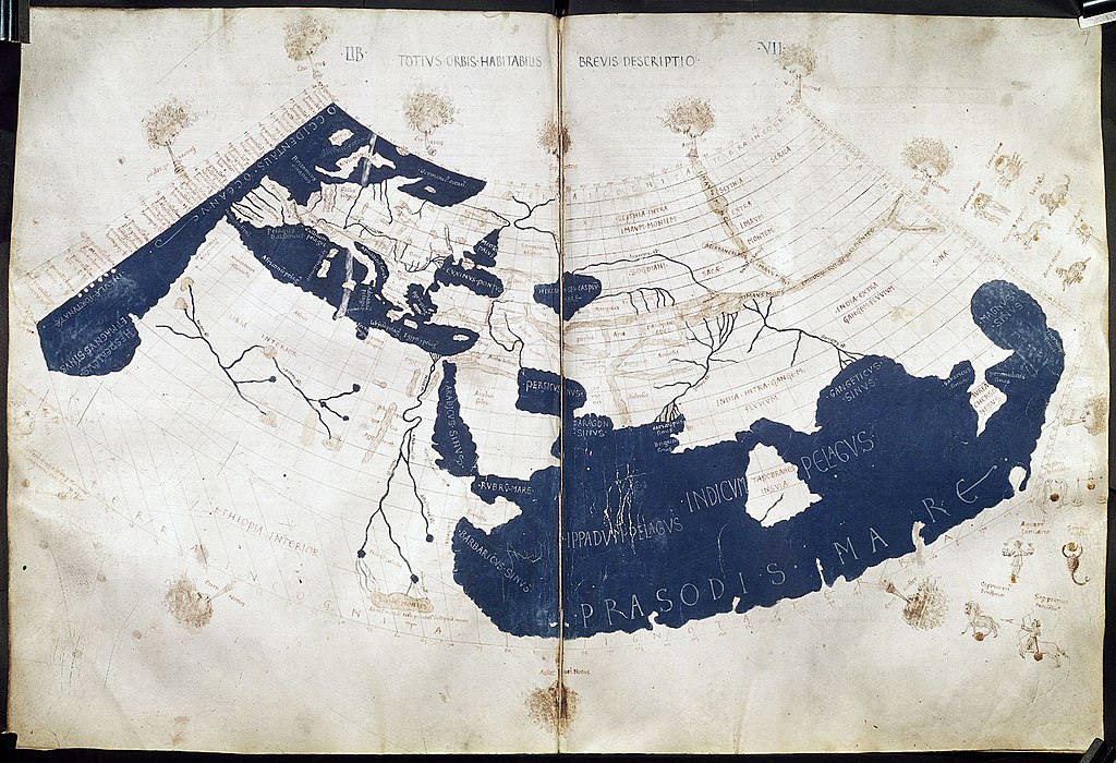
| Ptolemy's world map, reconstituted from Ptolemy's Geographia in the 15th century |
The exhibit, titled "Measuring and Mapping Space: Geographic Knowledge in Greco-Roman Antiquity" is located in Manhattan and runs through January 5, 2014, but has a very strong web presence. Included online are copies of the printed material, online resources, a YouTube video, and an extensive checklist of objects on display.
Roger S. Bagnall, a director at the institute, noted that "Our exhibitions and digital teams present a 21st-century approach to the ancient mentality concerning geographic space and how it is represented." Scholars should, when possible, try to see the world in the eyes of the historical subjects they are researching. One of the exhibit's guest curators said that "Geography is not just maps. There is also the cognitive side underlying mapping."
As John Wilford Noble notes in a New York Times piece on the exhibit, the worldview and conceptions of the classical thinkers deeply influenced the explorers of the first European Age of Exploration. Wilford notes: "Even Ptolemy’s errors were influential. Instead of sticking to Eratosthenes’ more accurate estimate of Earth’s size, Ptolemy handed down a serious underestimate that later apparently emboldened Columbus to think he could sail west to reach China or Japan."
- Measuring and Mapping Space: Geographic Knowledge in Greco-Roman Antiquity at ISAW
- Measuring and Mapping Space video on YouTube
- "The World as They Knew It: The Legacy of Greco-Roman Mapmaking," New York Times, by John Wilford Noble
No comments:
Post a Comment