05 September 2012

Wreck of Robert Falcon Scott’s Ship Discovered Off the Coast of Greenland

The Terra Nova in December 1910
The British Antarctic Expedition 1910, led by Robert Falcon Scott, failed to be the first expedition to the South Pole, arriving thirty-three days after the Norwegian expedition of Roald Amundsen.  Scott and his expedition perished on the return voyage from the pole.  The ship that took them there, the SS Terra Nova, sailed home and resumed its career as a sealing ship before it was lost in the Arctic transporting supplies in the Second World War.  A US research company, Schmidt Ocean Institute, discovered the ship 1,000 feet below the surface off the coast of Greenland.

Click here for more information on Scott's last ship

24 July 2012

New newsletter!

The latest issue of the SHD newsletter Terrae Cognitae has been published here.  You'll find abstracts for the upcoming meeting in Pasadena, and other member news.  Happy reading!

09 July 2012

A new copy of a 1507 Waldseemüller "America" map


A new version of the small globe gores by Martin Waldseemüller and Matthias Ringmann from 1507, which gave the name "America" to the South American continent, was recently discovered in Munich.
  
For more on this see this article from the The Chronicle of Higher Education: "An American Treasure Turns Up at Ludwig Maximilian U. of Munich"

Click here for more on Waldseemüller and his maps

25 June 2012

Tentative schedule for the SHD Annual Meeting–Pasadena, California September 28-30, 2012


SHD Annual Meeting – Pasadena, California
September 28th – 30th, 2012

FRIDAY

  • Breakfast on your own at Hilton.
  • Registration: Remaining packets will be taken from the hotel to Friends Hall for distribution.
  • Coffee, teas, and breakfast pastries will be available from 8:30-12:00, Friends Hall
Welcome and Opening Remarks 9:00-9:10 Ron Fritze and Bill Warren


Session I (9:10-10:20): PACIFIC – THE EXPEDITIONS

  • Pflederer, Richard - Magellan, the Pacific Ocean and the Search for the Anti-Meridian
  • Harreld, Donald - Strategies and Identities: Dutch Expeditions through the Strait of Magellan, 1598-1618
Coffee/Tea Break


Session II (10:35-11:45) : PACIFIC – THE CREWS

  • Flannery, Kristie - “Everyone a mutineer”: the crisis of maritime labour in Spanish voyages of discovery and conquest in the Pacific, 1564-1566
  • Delaney, John - Endeavour in Australia: Crewing with Cook
Lunch 12:00-13:00


Session III (13:00-14:10): LATIN AMERICA

  • Brunelle, Gayle - The Assassination of the Sieur de Royville and the Debacle of the Compagnie de l’Amerique Equinoxiale, 1653-1656
  • Mullan, Anthony - The Comisión Corográfia and Colombia’s Quest for Identity

Session IV (14:10-15:20: NORTH AMERICA

  • Buisseret, David - The Influence of Marquette and Jolliet on the Mapping of North America
  • Olcelli, Laura - The Denied Search for the North-West Passage: Alessandro Malaspina at the Service of “the nation that has taken me as one of its own!”

Coffee/Tea Break


Session V (15:40-16:50): TRANSATLANTIC CONTACTS

  • Francaviglia, Richard - Discovery and Faith: Re-examining Claims about Pre-Columbian Muslims in America
  • Herbert, Francis - The Hakluyt Society’s publications and the Americas: maps and membership from the 1840s

Annual SHD Business Meeting 17:00-17:45


Reception 18:30-19:30 (at the Pasadena Hilton, site of the Annual Dinner)


Annual Dinner and Presentation on SHD 2013 in Tampa, FL


Keynote Address
Dr. Peter C. Mancall, University of Southern California Professor, Director of the USC-Huntington Early Modern Studies Institute, and author of five books including Fatal Journey: The Final Expedition of Henry Hudson, and Hakluyt's Promise.


SATURDAY

  • Coffee, teas, and breakfast pastries will be available from 8:30-12:00, Friends Hall

Sessions VI & VII (9:00-10:45): FROM CALIFORNIA TO THE GULF OF MEXICO

  • Altic, Mirela - Missionary Cartography of Tarahumara
  • Ortiz, Ann - Epistolar Representation of Fray Junípero Serra in Francisco de Palóu’s Relacion Historica de la Vida y Apostolicas Tareas del Venerable Padre Fray Junipero Serra (1787)
  • Dellinger, Justin (Winner of Essay Competition) - La Balise: A Transimperial Focal Point

Coffee/Tea Break


Session VIII (11:00-12:10): AFRICA

  • Van Duzer, Chet - On Second Thought: Cartographic Corrections to the Shape of Africa on Medieval and Renaissance Maps
  • Hogarth, Donald - Robert Rich Sharp (1881-1958): prospector, engineer, and discoverer of the Shinkolobwe, Katanga, (Congo) radium-uranium ore-body

Closing Remarks by Ron Fritze and Bill Warren

22 June 2012

2012 SHD Essay Prize Winner

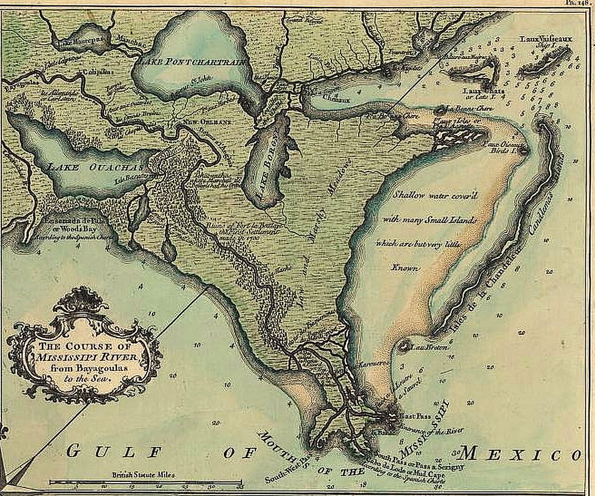
The Course of the Mississipi River, 1759

We are pleased to announce that the winner of this year's SHD essay contest is Justin T. Dellinger, Ph.D. student at the University of Texas at Arlington, for his paper, "La Balise: A Transimperial Focal Point."  Mr. Dellinger plans to present his paper at this year's Annual Meeting in Pasadena.


Abstract: "La Balise: A Transimperial Focal Point"
From the late seventeenth through the early nineteenth century, the mouth of the Mississippi River became a place of imperial competition.  The British, French, and Spanish all sought to control this outlet, which effectively served as the gateway to the heart of North America.  Initially, Europeans had little understanding of what encompassed the entire Mississippi River Valley, but they did understand the importance of controlling major river systems for political, economic, and military reasons.  Economically, controlling the Mississippi River would mean that any major trade in the larger region would funnel down to its mouth.  As the French established control of this region, what they would call La Louisiane, they constructed a post called la Balise to serve as both an access point and a buffer for inter-imperial contact.  Balise means seamark or beacon in French, so its name is very appropriate since it became such an important focal point.  Although its original significance was political, economic, and military for French policy makers, the Balize later took on a larger meaning for the mouth of the Mississippi River.


This settlement is understudied and more work needs to take place researching this frontier within a frontier.  It never had a large population, it proved difficult to fortify, and it constantly faced obliteration from hurricanes, yet the Balize became a well-known, recognized location.  Seventeenth- through nineteenth-century maps provide an important visual representation of this phenomenon.  As this period progressed, maps illustrated the shift from the use of terms such as “embouchure”, “boca”, and “mouth” to “Balise”, "Baliza”, and “Balize”.  Larger scale maps depicting continental North America, the Gulf of Mexico, and the Caribbean also evince how the Balize flanks and complements New Orleans as the distinct names along the Gulf Coast.  Both points illustrate the transimperial understanding of the role of the Balize as toponym for the mouth of the Mississippi River.


Biographical information
Justin T. Dellinger is a second-year doctoral student at the University of Texas at Arlington.  He received his Bachelor’s Degrees in History and Spanish from the University of Texas at Austin in 2004.  After teaching for a few years, he returned to school and earned his Master’s Degree in History at the University of Texas at Arlington in 2010.  His primary area of study is eighteenth-century Louisiana, employing transatlantic and cartographic approaches in his research.


More on the annual meeting can be found here

23 May 2012

SHD 2012 Pasadena Meeting
List of Speakers
Pasadena/San Marino, California, September 27-30, 2012
(As of 23 May 2012)

Altic, Mirela
Missionary Cartography of Tarahumara

Brunelle, Gayle
The Assassination of the Sieur de Royville and the Debacle of the Compagnie de l’Amerique Equinoxiale, 1653-1656

Buisseret, David
The Influence of Marquette and Jolliet on the Mapping of North America

Delaney, John
Endeavour in Australia: Crewing with Cook

Flannery, Kristie (Graduate Student)
“Everyone a mutineer”: the crisis of maritime labour in Spanish voyages of discovery
and conquest in the Pacific, 1564-1566

Francaviglia, Richard
Discovery and Faith:  Re-examining Claims about Pre-Columbian Muslims in America

Harreld, Donald
Strategies and Identities: Dutch Expeditions through the Strait of Magellan, 1598-1618

Herbert, Francis
The Hakluyt Society’s publications and the Americas: maps and membership from the 1840s

Hogarth, Donald
Robert Rich Sharp (1881-1958): prospector, engineer and discoverer of the Shinkolobwe, Katanga, (Congo) radium-uranium ore-body

Mullan, Anthony
The Comisión Corográfia and Colombia’s Quest for Identity

Olcelli, Laura (Graduate Student)
The Denied Search for the North-West Passage: Alessandro Malaspina at the Service of “the nation that has taken me as one of its own!”

Ortiz, Ann
Epistolar Representation of Fray Junípero Serra in Francisco de Palóu’s Relacion Historica de la Vida y Apostolicas Tareas del Venerable Padre Fray Junipero Serra (1787)

Pflederer, Richard
Magellan, the Pacific Ocean and the Search for the Anti-Meridian

Van Duzer, Chet
On Second Thought: Cartographic Corrections to the Shape of Africa on Medieval and Renaissance Maps

Preliminary meeting details can be found here

18 May 2012

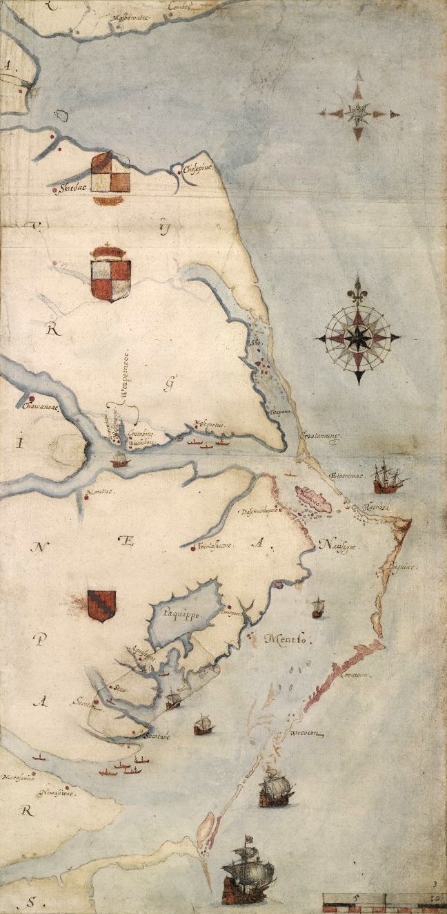
Sixteenth-century map by explorer and artist John White yields a new clue in the Roanoke mystery

Detail from La Virginea Pars by John White
Researchers from the First Colony Foundation and the British Museum believe that enhanced imagery from John White's (c. 1540-c. 1593) map La Virginea Pars, from the 1580s, may offer clues to what happened to the colonists from the "Lost Colony" of Roanoke.  Looking under a patch on the map with ultraviolet light, they found a symbol for a fort, indicating a place the beleaguered English colonists may have moved.