15 February 2013

"Dr. Livingstone, I presume?"

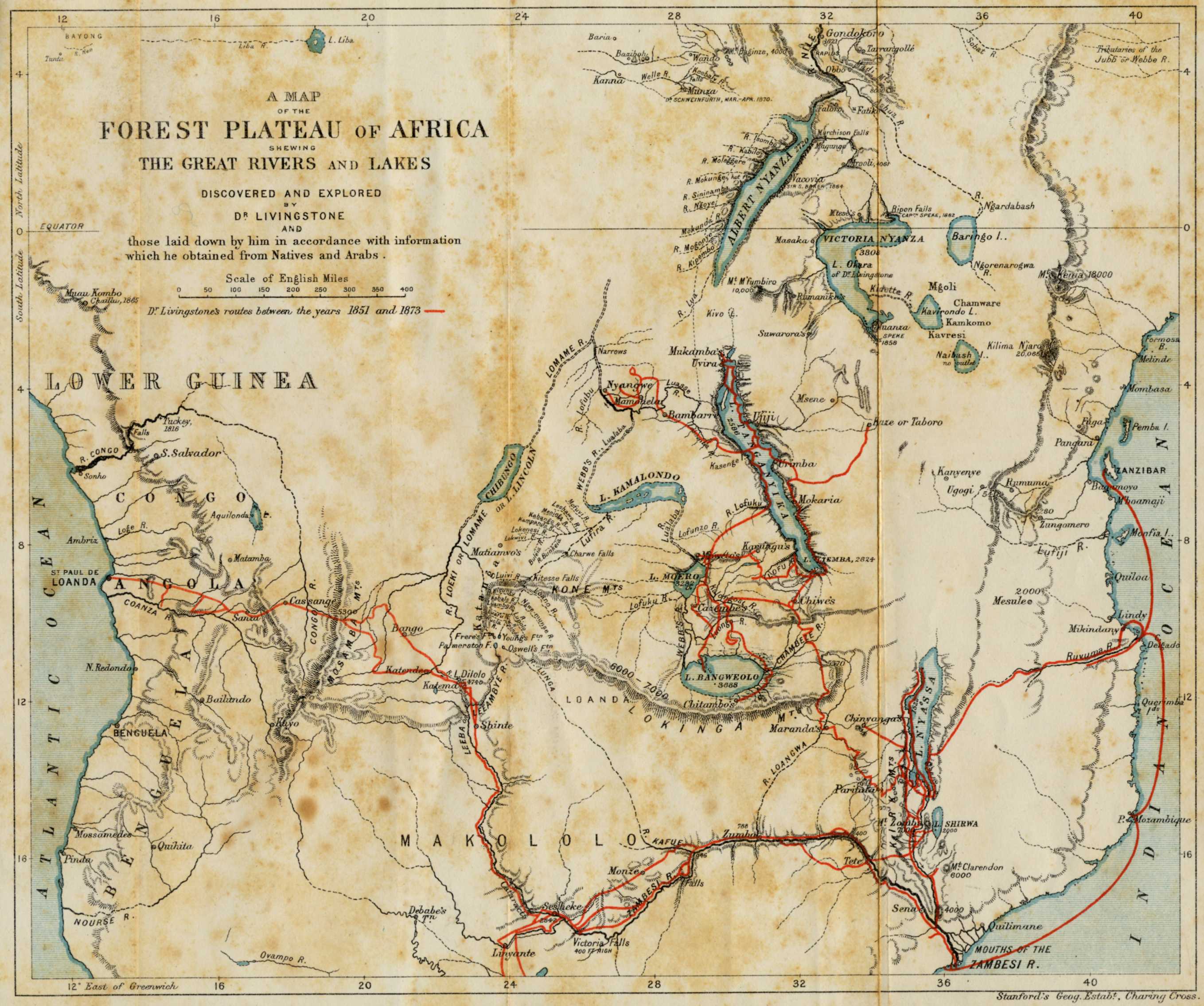
Map of the Travels of David Livingstone in Africa, 1873
March 19, 2013, is the 200th anniversary of the birth of Dr. David Livingstone (1813-1873), the Scottish medical missionary and explorer of Africa.  The National Museum of Scotland is hosting an exhibit titled "Dr Livingstone, I presume?" that runs through April 7, 2013, in Edinburgh.  Among the more than 100 artifacts on exhibit are the hats worn by Livingstone and H. M. Stanley (1841-1904) when Stanley found Livingstone (who had lost touch with the outside world) on November 10, 1871, near Lake Tanganyika in eastern Africa.

This is one of the several events meant to celebrate the 200th anniversary of Livingstone's birth that are planned for the year 2013 in both Europe and Africa.

03 February 2013

Alexine Tinné exhibit in the Netherlands

Copyright reserved by the Haags Historisch Museum
As a tie-in to the article "Alexine Tinné: Nineteenth-Century Explorer of Africa" by scholar Mylynka Kilgore Cardona in the most-recent issue of Terrae Incognitae (the journal for the Society of the History of Discoveries), the Haags Historisch Museum (Historical Museum of The Hague) is currently hosting an exhibit titled "Alexine Tinne. Afrikaanse avonturen van een Haagse dame" (Alexine Tinne: African adventures of a  Hague lady).  Alexine Tinné (1835-1869) traveled and explored in Egypt, the Sudan, the upper Nile, and the Sahara.  The adventuress's personal belongings, photographs, and ethnographic artifacts are on display until March 24, 2013.

28 January 2013

Latest issue of SHD's journal is published, with a freebie

The latest issue of Terrae Incognitae, the scholarly journal for the Society of the History of Discoveries, is out and it is a special issue on the exploration of Africa.  Here is the table of contents:

  • Exploration in the Nineteenth Century by Imre Josef Demhardt
  • The Cartography of Exploration: Livingstone's 1851 Manuscript Sketch Map of the Zambesi River by Elri Liebenberg
  • The Reverend Charles New: Nineteenth-Century Missionary and Explorer in Eastern Equatorial Africa by Sanford H. Bederman
  • Alexine Tinné: Nineteenth-Century Explorer of Africa by Mylynka Kilgore Cardona
  • Hermann Habenicht's Spezialkarte von Afrika - A Unique Cartographic Record of African Exploration 1885-1892 by Wulf Bodenstein
  • Recent and Upcoming Literature in Discovery History
  • Book Reviews
The publisher has granted free public access to the introductory essay "Exploration in the Nineteenth Century" by Imre Josef Demhardt.  So, learn about the history of nineteenth-century European exploration of Africa and join SHD to get the printed journal!

18 January 2013

American Indians in Viking Iceland? Yes, says DNA.

The Skálholt Map, a copy of a 16th century Icelandic map,
showing Norse lands and their discoveries in the Americas.
Geneticists have discovered 80 living Icelanders with mitochondrial-DNA (a type of DNA passed from mother to child) signatures similar to Native American Indians.  The evidence suggests that this DNA entered the Icelandic bloodlines around AD 1000, which means that early Viking explorers and settlers to the New World may have brought at least one Indian woman back to Iceland with them.  There are no suggestions in  the in historical records, such as the Icelandic sagas, that women were brought back to Icelandthis may indicate that there were many more voyages to Vinland and other points west than were recorded, and much more contact between Vikings and Skraelings (what the Norsemen called the Amerindians) than previously suggested.

21 December 2012

How the undiscovered Sandy Island was "discovered"

The 1908 map showing Sandy Island, circled (map from the Auckland Museum blog).  
The saga of the phantom island named Sandy Island between New Caledonia and Australia, which showed up on many charts and Google Maps may have been solved by a Shaun Higgins, a librarian at Auckland Museum, New Zealand.  In November 2012, Australian scientists on the RV Southern Surveyor found that the island did not exist.  Higgins, based on a 1908 British admiralty chart, traced the "Sandy Island" to a false sighting of land by the crew of the whaling ship from Velocity in 1876.

14 December 2012

AHA Session: Women and Maps in Early Modernity


Terrae InBLOGnitae readers and SHD members might be interested in this call for papers for 2014's AHA annual meeting in Washington, DC:

Women and Maps in Early Modernity

Abstracts are invited for papers about "Women and Maps in Early Modernity," for a possible Society for the Study of Early Modern Women co-sponsored session at the American Historical Association's annual meeting in Washington, DC, in January 2014.

Papers from a range of disciplines—including, but not limited to, history, art history, literary studies, and historical geography—which address the nexus between early modern women and maps/cartography in any geographical region or culture, during the time period c. 1400-1700 are sought. Paper topics might consider women as:

  • Explorers contributing data from which maps are made
  • map illustrators
  • printers/publishers/sellers of maps
  • navigators/users of maps
  • writers on the topic of cartography

Abstracts (400-500 words) for papers twenty minutes in length should be submitted by January 10, 2013, by e-mail, to Allyson Poska (aposka@umw.edu) and Erika Gaffney (egaffney@ashgate.com).

26 November 2012

Scientific expedition "un-discovers" Sandy Island

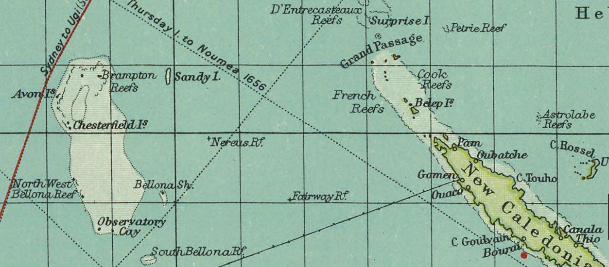
Sandy Island on a British map, 1922.
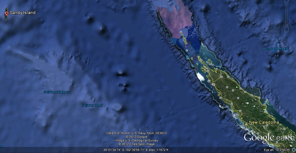
Sandy Island on Google Earth, 2012.
On November 22, 2012, an expedition of Australian scientists from the University of Sydney on the RV Southern Surveyor, studying plate tectonics in the Coral Sea, noticed that some maps showed an isle named Sandy Island between French-governed New Caledonia and Australia while others did not.  The expedition found no island at the location, though European maps dating back to Captain Cook's 1774 expedition showed a "Sandy Island" or "Île de Sable" somewhere near New Caledonia.  (Some maps showed two Sandy Islands.)  The Australian expedition instead found 4,600 feet (1,400 meters) of ocean depth.