 |
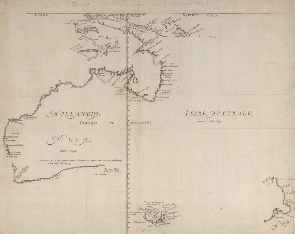
| Hollandia Nova detecta 1644, a French copy (by Melchisedech Thevenot, 1663) of an earlier map by Dutch cartographer Joan Blaeu, based on information from voyages by Abel Tasman and Willem Jansz. The map shows only the northern, western, and southern coasts of Australia. |
The eastern coast of Australia, the history books tell us, was first seen by Europeans in 1770,
when Captain James Cook's expedition explored the coast, but a skull discovered in 2011 might challenge that view.
Scientists from Australian National University tested a skull found in northern New South Wales in late 2011, revealing it to be from a Caucasoid male born around 1650—much too early to be a part of Cook's expedition. Australia was first sighted by European explorers in early 1606 by the Dutch navigator Willem Janszoon. Over the rest of the century, there are records of several Dutch expeditions exploring the northern, western, and southern coasts—but not the east. (Some writers claim that
the Portuguese may have discovered Australia earlier, but they offer no definitive proof.)
Could the Dutch, or some other European power, have explored the eastern coast of Australia before Cook's 1770 voyage? Or can the skull be explained away?